





Albuquerque’s Skyline and the Sandia Foothills
The skyline of Albuquerque is a unique blend of high-desert urbanity and dramatic natural geology. Unlike traditional vertical cities, Albuquerque’s beauty lies in its vast horizontal scale and the granite peaks that frame it.
Overview of Albuquerque’s Skyline
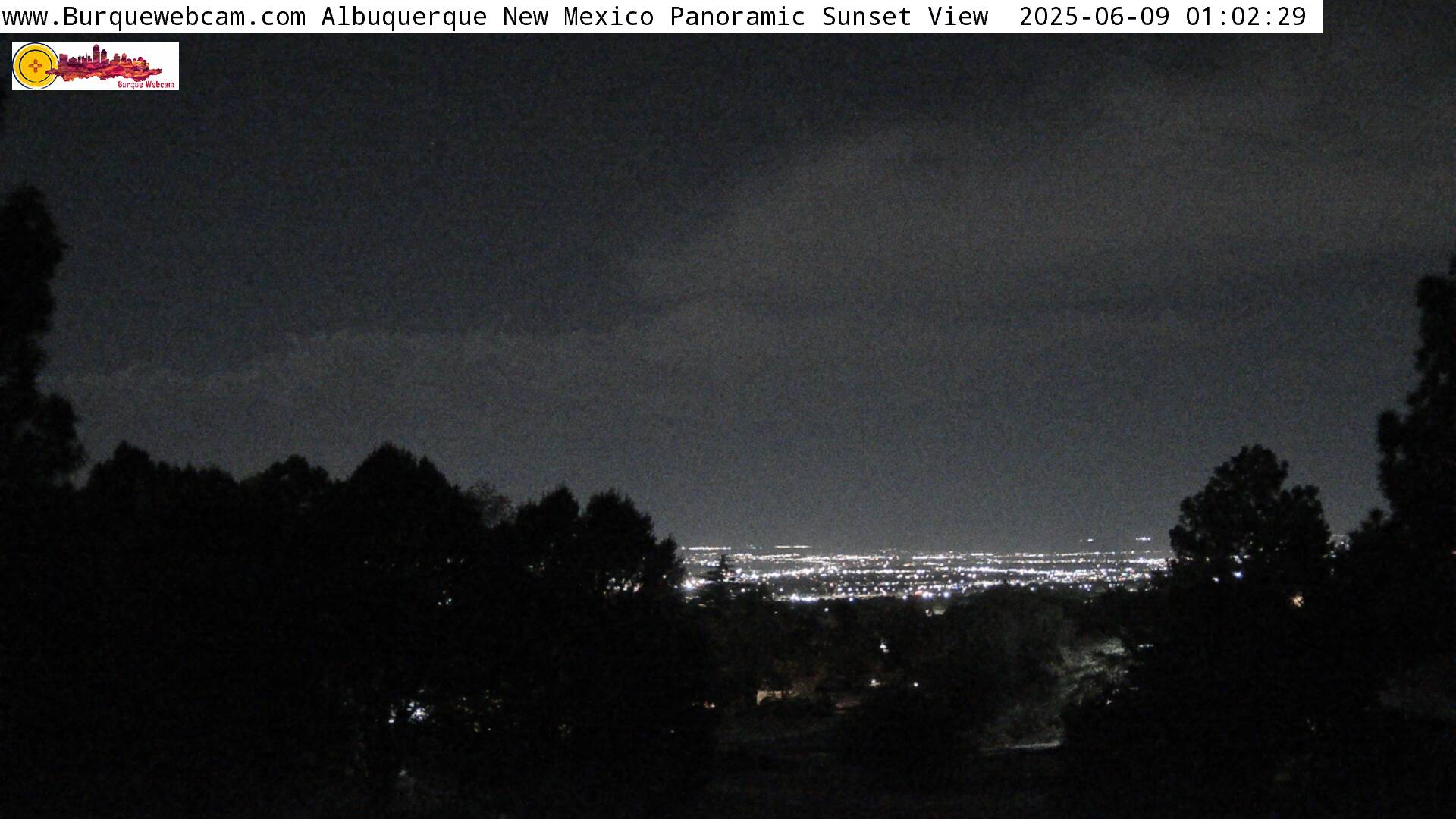
The city’s silhouette is defined by two distinct elements: the Downtown Core, featuring the city’s tallest modern architecture, and the Sandia Mountains, which serve as a 10,000-foot-tall backdrop. This relationship creates a “bowl” effect where the urban lights are cradled by the surrounding high-desert plateau.
Best Times to View the Skyline
- The “Watermelon” Glow: Named Sandia (Spanish for watermelon) for a reason—at sunset, the granite faces turn a vibrant pink.
- The Blue Hour: The 20 minutes following sunset provide the best lighting to capture the balance between the fading mountain light and the emerging city “twinkle.”
- Balloon Fiesta Dawn: During early October, the skyline is famously dotted with hundreds of hot air balloons during the Mass Ascension.
Exploring the Sandia Foothills
The foothills act as the gateway between the city’s edge and the wilderness of the Cibola National Forest.
Hiking Trails in the Sandia Foothills
- Elena Gallegos Open Space: The gold standard for accessible hiking with unobstructed views of the city below.
- Pino Trail: A steady, rewarding incline that takes you through various desert life zones.
- Embudito Trail: A more rugged, rocky path favored by those looking for a steeper challenge and unique rock formations.
Wildlife and Nature Around the Foothills
The ecosystem here is a vibrant “transition zone.” Visitors often spot mule deer, coyotes, and the Greater Roadrunner. The flora is dominated by hardy desert species such as cholla cactus, prickly pear, and fragrant piñon pine, which give the air its distinct New Mexican scent.
Photography and Visitor Tips
Capturing the essence of the Duke City requires a bit of planning regarding gear and safety.
Photography Tips for Capturing the Skyline
- Perspective Matters: To make the mountains look massive behind the buildings, use a telephoto lens from the West Mesa to “compress” the distance.
- Stability: High-desert winds are common; a heavy tripod is essential for sharp long-exposure shots of the city lights.
- Filter Use: A graduated neutral density filter can help manage the high contrast between the bright sky and the darker mountain shadows.
Safety Tips for Visitors
- High Altitude: Albuquerque sits at over 5,000 feet. Drink double the water you think you need to avoid altitude sickness.
- Sun and Skin: The UV rays are much stronger at this elevation. Sunscreen is a year-round requirement.
- Trail Etiquette: Stay on marked paths to avoid disturbing the fragile desert crust and to steer clear of rattlesnakes, which are active during warmer months.
Local Connections and Access
Local Attractions Near the Sandia Foothills
- Sandia Peak Tramway: For the ultimate view, take the tram to the crest to look down on the entire Rio Grande Valley.
- High Desert Architecture: Drive through the nearby neighborhoods to see how local builders use “Santa Fe Style” to blend homes into the natural landscape.
How to Access Live Views of the Skyline
For real-time weather and lighting conditions, the Sandia Peak Webcams and local news stations like KRQE offer 24/7 live feeds of the mountains and the Downtown corridor.
Conclusion and Final Thoughts
Albuquerque offers a rare visual drama where the line between civilization and wilderness is beautifully blurred. Whether you are a photographer, a hiker, or a casual traveler, the skyline represents the enduring “Enchantment” of New Mexico.
Live Weather for Live Albuquerque City Skyline Webcam – Sandia Foothills, New Mexico Webcam
3 Day Forecast
-
Today75°°F 70°clear sky0 inch
-
Tomorrow86°°F 56°clear sky0 inch
-
Friday84°°F 63°broken clouds0 inch
- Summary
- Hourly
- More Details
-
Today
80°°F clear sky
0% 9 knNow -
Tomorrow
73°°F clear sky
0% 14 kn6:00 PM -
67°°F scattered clouds
0% 10 kn9:00 PM -
58°°F few clouds
0% 9 kn12:00 AM -
56°°F clear sky
0% 12 kn3:00 AM -
56°°F clear sky
0% 6 kn6:00 AM -
67°°F few clouds
0% 5 kn9:00 AM -
80°°F clear sky
0% 9 kn12:00 PM -
86°°F broken clouds
0% 20 kn3:00 PM -
Friday
82°°F broken clouds
0% 19 kn6:00 PM -
71°°F broken clouds
0% 7 kn9:00 PM -
63°°F broken clouds
0% 14 kn12:00 AM -
63°°F broken clouds
0% 6 kn3:00 AM -
63°°F overcast clouds
0% 3 kn6:00 AM -
73°°F scattered clouds
0% 7 kn9:00 AM -
82°°F scattered clouds
0% 18 kn12:00 PM -
84°°F few clouds
0% 17 kn3:00 PM -
Saturday
84°°F few clouds
0% 20 kn6:00 PM -
73°°F clear sky
0% 12 kn9:00 PM -
65°°F clear sky
0% 5 kn12:00 AM -
60°°F clear sky
0% 3 kn3:00 AM -
57°°F clear sky
0% 5 kn6:00 AM -
65°°F clear sky
0% 6 kn9:00 AM -
73°°F clear sky
0% 6 kn12:00 PM
Live I-25 Southbound Webcam – Bernalillo, Albuquerque, NM
I-25 Southbound: Bernalillo / US-550 (Mile Marker 242) The traffic camera for I-25 Southbound (NMDOT Camera 412091) is a critical vantage point located at Mile Marker 242.1 within the Exit
Live I-25 Southbound Webcam – BIA 105 SW Bound, Albuquerque, NM
I-25 Southbound: BIA-105 / Bosque Farms (Mile Marker 209) The traffic camera for I-25 Southbound (NMDOT Camera 412056) is located at Mile Marker 209.1 within the Exit 209 interchange. Situated
Live I-25 Southbound Webcam – US 550, Albuquerque, NM
Show thinking Gemini said I-25 Southbound: Bernalillo / US-550 (Mile Marker 242) The traffic camera for I-25 Southbound (NMDOT Camera 412091) is a critical vantage point located at Mile Marker
Live I-25 Webcam – Jefferson St Underpass (Looking North), Albuquerque, NM
I-25 Looking North: Jefferson St Underpass (Mile Marker 229) The traffic camera for I-25 (NMDOT Camera 412076) is situated at Mile Marker 229.1 within the complex Exit 229 interchange. This
Live US 550 Webcam (Looking North East) – West of River Bridge, Albuquerque, NM
US 550 Looking Northeast: Rio Grande River Bridge (Bernalillo) The traffic camera for US 550 (NMDOT Camera 412133) is a vital monitoring point for the heavy commuter traffic crossing the
Live I-25 Northbound Webcam – US 550, Albuquerque, NM
I-25 Northbound: Bernalillo / US-550 (Mile Marker 242) The traffic camera for I-25 Northbound (NMDOT Camera 412091) is a vital monitoring point for the northern end of the Albuquerque metropolitan
Live I-25 Webcam – Lead Ave at Oak St On-Ramp (Looking North), Albuquerque, NM
I-25 Looking North: Lead Ave / Oak St (Mile Marker 224) The traffic camera for I-25 (NMDOT Camera 412067) is a critical vantage point situated at Mile Marker 224.2 near
Live I-40 Westbound to I-25 Southbound Webcam – Albuquerque, NM
I-40 WB to I-25 SB Flyover: The Big I (Mile Marker 158) The traffic camera monitoring the I-40 Westbound to I-25 Southbound transition (NMDOT Camera 412088) is a vital piece
Live I-25 SB Traffic Webcam – Rio Bravo Boulevard Overpass, Albuquerque, NM
I-25 Southbound: Rio Bravo Blvd (Mile Marker 220) The traffic camera for I-25 Southbound (NMDOT Camera 412062) is located at Mile Marker 220.1 within the Exit 220 interchange. This site

Live Spanish Peaks Webcam – San Isabel National Forest, Colorado
Live View: Sangre de Cristo Mountains & The Spanish Peaks Welcome to a spectacular high-altitude perspective from South Central Colorado. Our state-of-the-art Pan-Tilt-Zoom (PTZ) webcam is situated in the rugged
Live I-25 Webcam – Isleta Blvd (Looking East), Albuquerque, NM
I-25 Looking East: Isleta Blvd (Mile Marker 213) The traffic camera for I-25 (NMDOT Camera 412057) is a vital monitoring point for the southern gateway to Albuquerque, located at Mile
Live I-25 Northbound Webcam – NM 6 NE On Ramp, Albuquerque, NM
I-25 Southbound: Los Lunas / NM 6 (Mile Marker 203) The traffic camera for I-25 Southbound (NMDOT Camera 412053/412054) is located at Mile Marker 203.1 within the Exit 203 interchange.
Live I-25 Webcam Northbound Traffic – Bobby Foster Road, Albuquerque, NM
I-25 Northbound: North of Los Lunas (Mile Marker 206) The traffic camera located at the specific coordinates provided serves as a rural monitoring point for Northbound I-25. Positioned at approximately
Live I-25 Webcam Southbound Traffic – Bobby Foster Road, Albuquerque, NM
I-25: Bobby Foster Rd (Mile Marker 218) The traffic camera cluster for I-25 (NMDOT Camera 412060 / 412061) is a primary monitoring point for the burgeoning industrial and film district
Live I-25 Northbound Webcam – Central Ave Overpass (Southbound Off-ramp), Albuquerque, NM
I-25 Northbound: Central Ave / Route 66 (Mile Marker 224) The traffic camera for I-25 Northbound (NMDOT Camera 412068) is located at Mile Marker 224.5 at the Exit 224C interchange.